美国农业部地表植被燃烧严重程度趋势 (MTBS)数据集

地面火灾数据集
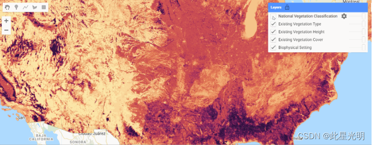
LANDFIRE (LF),即 "地貌火灾和资源管理规划工具",是美国农业部森林服务局、美国内政部地质调查局和大自然保护协会的野地火灾管理项目之间的共享项目。
LANDFIRE (LF) 图层是利用基于大量实地参考数据、卫星图像和生物物理梯度图层的预测性景观模型,通过分类和回归树创建的。您可在此阅读有关地火 2022 更新版本 2.3.0 的信息
LANDFIRE (LF) 2022 更新是向年度更新迈出的又一步。此次更新是 LANDFIRE 历史上首次在当年的产品中体现前一年的干扰情况。LF 2022 包括对 2021 年和 2022 年记录的扰动区植被和燃料的调整。LF 2022扰动图层包含从国家和地方来源获得的综合多边形处理数据(扰动事件)以及火灾计划数据,其中包括:
燃烧严重程度监测趋势 (MTBS)
烧伤区域反射率分类 (BARC)
野火后植被状况快速评估 (RAVG)
LF 的景观变化遥感技术(RSLC)也能识别干扰,该技术利用自动算法和图像分析师对整个国家的审查来识别植被的光谱变化。
2023 年,受干扰地区的植被覆盖度和高度以及燃料都将具备能力。这意味着在绘制的扰动区,植被和燃料代表了当年的状况。植被过渡规则集考虑了 2017 年至 2022 年的扰动情况,因为这些规则集的设计使用了 LF 2016 重绘植被数据作为输入。燃料更新使用 2013-2022 年的扰动,因为燃料过渡规则包含十年的扰动,可以使用扰动前的燃料输入。
LF 2022 更新中的重要变化包括
现有植被类型 (EVT) 生态系统分类将与 LF 2020 保持一致,但农业或城市地区发生变化的区域除外
LF 2022 包含植被高度和覆盖过渡规则的 "零到一 "干扰后时间 (TSD) 规则的首次应用
为地表燃料过渡制定了新的 "零到一 "TSD 类别规则,旨在体现扰动对紧随扰动之后的生长季节的燃料的影响。
历史扰动 (HDist) 和燃料扰动 (FDist) 所代表的年份现在是相同的
当前的代码更新
Earth Engine Snippet: Fire Regime v2.3.0
Sample Code:
Earth Engine Snippet: Disturbance 2.3.0
Sample Code:
Earth Engine Snippet: Topographic 2.2.0
Sample Code:
Earth Engine Snippet: Fuel 2.3.0
Earth Engine Snippet: Fuel 2.2.0
Sample Code:
Earth Engine Snippet: Vegetation 2.3.0
Sample Code:
Earth Engine Snippet: Transportation 2.2.0
Sample Code:
Resolution: approx 30m
Citation
LANDFIRE 空间数据产品
Homepage title: Data product.(Last update). Agency. [Online].Available: URL [Access date].
License
LANDFIRE data are public domain data with no use restrictions, though if modifications or derivatives of the product(s) are created, then please add some descriptive modifier to the data set to avoid confusion.
Curated in GEE by: Samapriya Roy
Keywords: doi, fire, landfire, nature-conservancy, usda, usgs, vegetation, wildfire
Last updated: 2024-01-14
Changelog
- 2024-01-14 Updated to v2.2.3 for available collections

- 点赞
- 收藏
- 关注作者
评论(0)