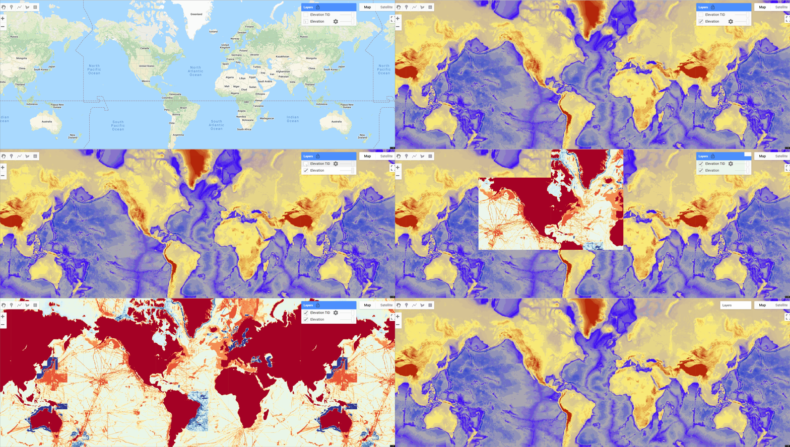
GEE:海洋总测深图数据集(GEBCO)
海洋总测深图数据集(GEBCO)
GEBCO_2021 Grid 是 General Bathymetric Chart of the Oceans (GEBCO) 发布的最新全球测深产品,由日本财团-GEBCO Seabed 2030 项目开发。
GEBCO_2021 网格在 43200 行 x 86400 列的 15 弧秒网格上提供以米为单位的全球高程数据覆盖,提供 3,732,480,000 个数据点。 弧秒。 该网格用作 SRTM15+ 数据集的“基础”版本 2(Tozer 等人,2019 年)。 该数据集融合了陆地地形与测量和估计的海底地形。 四个海底 2030 区域中心开发的网格化测深数据集对其进行了扩充。 区域中心为其责任区编制了主要基于多波束数据的网格测深数据集。 然后将这些区域网格提供给全球中心。
对于极地以外的区域(主要是 60°N 以南和 50°S 以北),这些数据集采用“稀疏网格”的形式,即仅填充包含数据的网格单元。 对于极地地区,由于合并极坐标中保存的数据的复杂性,提供了完整的网格。
从这些区域数据网格编制 GEBCO_2021 网格是在全球中心进行的,目的是生成一个无缝的全球地形模型。 GEBCO_2021 网格包括来自许多国际和国家数据存储库和区域绘图计划的数据集。 有关 GEBCO_2021 网格中包含的数据集的信息,请参阅此版本网格中包含的贡献列表。
数据引用:
GEBCO Compilation Group (2021) GEBCO 2021 Grid (doi:10.5285/c6612cbe-50b3-0cff-e053-6c86abc09f8f)
代码:
样例代码:
GEBCO Type Identifier (TID) grid coding
| TID | Definition |
|---|---|
| 0 | Land |
| Direct measurements | |
| 10 | Singlebeam - depth value collected by a single beam echo-sounder |
| 11 | Multibeam - depth value collected by a multibeam echo-sounder |
| 12 | Seismic - depth value collected by seismic methods |
| 13 | Isolated sounding - depth value that is not part of a regular survey or trackline |
| 14 | ENC sounding - depth value extracted from an Electronic Navigation Chart (ENC) |
| 15 | Lidar - depth derived from a bathymetric lidar sensor |
| 16 | Depth measured by optical light sensor |
| 17 | Combination of direct measurement methods |
| Indirect measurements | |
| 40 | Predicted based on satellite-derived gravity data - depth value is an interpolated value guided by satellite-derived gravity data |
| 41 | Interpolated based on a computer algorithm - depth value is an interpolated value based on a computer algorithm (e.g. Generic Mapping Tools) |
| 42 | Digital bathymetric contours from charts - depth value taken from a bathymetric contour data set |
| 43 | Digital bathymetric contours from ENCs - depth value taken from bathymetric contours from an Electronic Navigation Chart (ENC) |
| 44 | Bathymetric sounding - depth value at this location is constrained by bathymetric sounding(s) within a gridded data set where interpolation between sounding points is guided by satellite-derived gravity data |
| 45 | Predicted based on helicopter/flight-derived gravity data |
| Unknown | |
| 70 | Pre-generated grid - depth value is taken from a pre-generated grid that is based on mixed source data types, e.g. single beam, multibeam, interpolation etc. |
| 71 | Unknown source - depth value from an unknown source |
| 72 | Steering points - depth value used to constrain the grid in areas of poor data coverage |
License
The GEBCO Grid is placed in the public domain and may be used free of charge. Use of the GEBCO Grid indicates that the user accepts the conditions of use and disclaimer information given below. Users are free to: Copy, publish, distribute and transmit The GEBCO Grid. Adapt The GEBCO Grid. Commercially exploit The GEBCO Grid, by, for example, combining it with other information, or by including it in their own product or application.
Produced by : General Bathymetric Chart of the Oceans (GEBCO), Nippon Foundation-GEBCO Seabed 2030 Project
Curated by: Samapriya Roy
Keywords: :"Nippon Foundation-GEBCO Seabed 2030 Project, GEBCO, General Bathymetric Chart of the Oceans, Bathymetry , Elevation"
Last updated: 2021-09-29
GEE数据集:全球哥白尼数字高程模型DEM(GLO-30 DEM)
- 点赞
- 收藏
- 关注作者


评论(0)