探究大气生态系统:1996年BOREAS项目中南北研究区SLICER数据详解

BOREAS Scanning Lidar Imager of Canopies by Echo Recovery (SLICER): Level-3 Data
简介
为支持 BOREal 生态系统-大气研究 (BOREAS),在南部和北部研究区(分别为 SSA 和 NSA)的所有塔通量 (TF) 站点以及研究区之间的横断面上获取了回波恢复扫描激光雷达冠层成像仪 (SLICER) 数据。数据是在 1996 年 7 月 18 日至 30 日之间的 5 天内获取的。每个塔站点的覆盖范围通常为 40 公里长,每座塔上至少有 3 条线,最多有 10 条线,方向为各种方位角。SLICER 数据与高级固态阵列光谱仪 (ASAS) 高光谱多视角图像同时获取。SLICER 3 级产品由每条航线的二进制文件组成,每个激光发射的数据记录由 13 个参数和 600 字节的波形组成,波形是从地球表面反射的后向散射激光能量的原始记录。
摘要
Site boundaries: (All latitude and longitude given in decimal degrees)
|
Site (Region) |
Westernmost Longitude |
Easternmost Longitude |
Northernmost Latitude |
Southernmost Latitude |
|
Tower Flux (TF) sites in the Southern and Northern Study Areas of the BOReal Ecosystem-Atmosphere Study (BOREAS) region |
-106.19779 |
-98.02747 |
55.92842 |
53.62889 |
Study Area: The North American Datum of 1983 (NAD83) coordinates for the tower sites are:
|
Site |
Western Longitude |
Eastern Longitude |
Northern Latitude |
Southern Latitude |
|
NSA-BVP |
-98.02747 |
-98.02747 |
55.84225 |
55.84225 |
|
NSA-FEN |
-98.42072 |
-98.42072 |
55.91481 |
55.91481 |
|
NSA-OBS |
-98.48139 |
-98.48139 |
55.88007 |
55.88007 |
|
NSA-OJP |
-98.62396 |
-98.62396 |
55.92842 |
55.92842 |
|
NSA-YJP |
-98.28706 |
-98.28706 |
55.89575 |
55.89575 |
|
SSA-FEN |
-104.61798 |
-104.61798 |
53.80206 |
53.80206 |
|
SSA-OBS |
-105.11779 |
-105.11779 |
53.98717 |
53.98717 |
|
SSA-OJP |
-104.69203 |
-104.69203 |
53.91634 |
53.91634 |
|
SSA-YJP |
-104.64529 |
-104.64529 |
53.87581 |
53.87581 |
|
SSA-9OA |
-106.19779 |
-106.19779 |
53.62889 |
53.62889 |
|
SSA-9YA |
-105.32314 |
-105.32314 |
53.65601 |
53.65601 |
Companion File Information:
|
Companion File Name |
Description |
|
BOREAS_SLICER_NASA-LAPF_Instrument_and_DataDescription.pdf |
This document describes the Scanning Lidar Imager of Canopies by Echo Recovery (SLICER), an airborne laser altimeter and surface lidar instrument and data product description. |
|
BOREAS_SLICER_NASA-LAPG_TechnicalOverview.pdf |
Technical Overview of Boreas Slicer. Legacy guide format with 20 detailed sections. |
|
SLICER_inventory.csv |
Slicer inventory file. See the descriptions of the parameters contained in the SLICER inventory file in the table below. |
|
ELEVDIFF_readme.txt |
Script used to Measure the Elevation Difference |
|
FLUXTOWR_SUMMARY.txt |
Summary that lists, for each SLICER flight line, the BOREAS TF site(s) crossed by that flight line, and the approximate laser shot number in the data record closest to the tower. |
|
Code_PRO.zip |
Programs for use in IDL for interactively viewing and editing the data |
|
Flight_Line_Plots.zip |
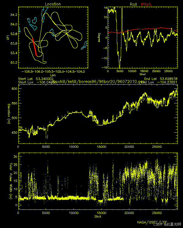
gif plots of location map, roll & pitch on the line, and profiles of elevation and total pulse width for each flight line |
|
Flight_Transect_Files.zip |
Detailed flight line maps showing the location of the laser footprint ground tracks in the vicinity of each TF site. |
|
Log_Notes.zip |
Instrument operator log notes for each flight day |
|
Trajectory_Files_and_Plots.zip |
GPS aircraft trajectory files stored as ASCII data. composed of one header record and then a data record for each GPS epoch. The header record consists of one parameter and a data record consists of eight parameters. The naming convention for these files consists of an eight-character name and a .trj suffix. The eight characters consist of YY_MM_DD, where YY is the last two digits of the year in which the data were collected, MM is the month of the year, and DD is the day of the month. |
Descriptions of the parameters contained in the SLICER inventory file
|
Column Name |
Unit of Measurement |
Description |
|
Spatial_Coverage |
The general term used to denote the spatial area over which the data were collected. |
|
|
Date_Obs |
DD-MON-YYYY |
The date on which the data were collected |
|
Start_Time |
HHMM GMT |
The starting GPS time for the data collected |
|
End_Time |
HHMM GMT |
The ending GPS time for the data collected |
|
Run_Start_Lat |
Decimal Degrees |
The WGS84 latitude coordinate at the beginning of the data line |
|
Run_Start_Long |
Decimal Degrees |
The WGS84 longitude coordinate at the beginning of the data line |
|
Run_End_Lat |
Decimal Degrees |
The WGS84 latitude coordinate at the end of the data line |
|
Run_End_Long |
Decimal Degrees |
The WGS84 longitude coordinate at the end of the data line |
|
Num_Shots |
Count |
The number of laser pulses for the data line |
|
CRTFCN_Code |
The BOREAS certification level of the data. Examples are CPI (Checked by PI), CGR (Certified by Group), PRE (Preliminary), and CPI-??? (CPI but questionable). |
代码
引用
Harding, D. 2016. BOREAS Scanning Lidar Imager of Canopies by Echo Recovery (SLICER): Level-3 Data. ORNL DAAC, Oak Ridge, Tennessee, USA.
网址推荐
知识星球
机器学习
干旱监测平台

- 点赞
- 收藏
- 关注作者
评论(0)