GHSL:全球2018 年建成面积(总建面和非住宅)的分布数据(10m分辨率)

GHSL: Global built-up surface 10m (P2023A)
GHSL:全球2018 年建成面积(总建面和非住宅)的分布数据(10m分辨率)
简介
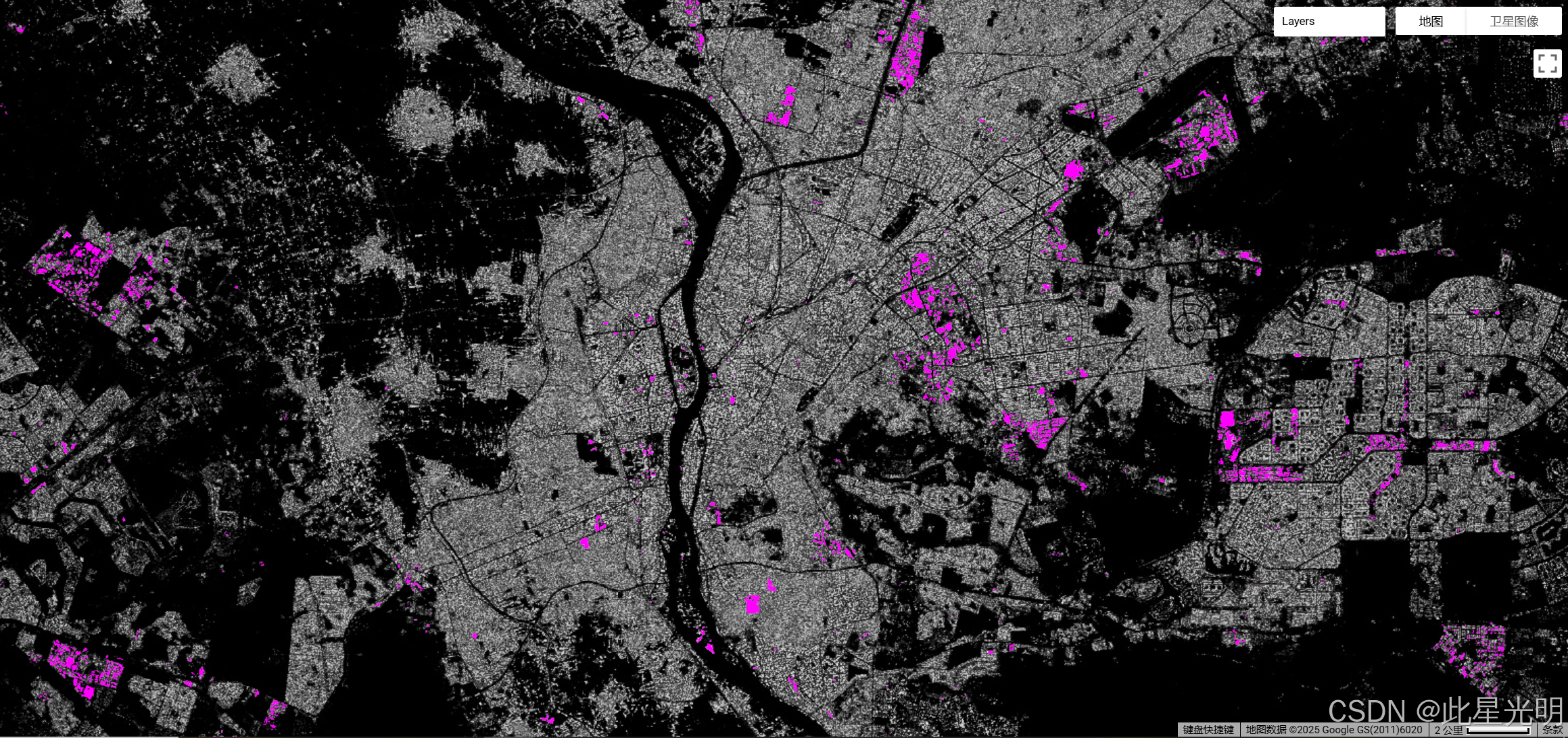
该栅格数据集描述了从 S2 图像数据中观测到的 2018 年建成面的分布情况(以每 10 米网格单元平方米表示)。 该数据集测量:a) 总建成面;b) 分配给主要非住宅(NRES)用途网格单元的建成面。
有关全球人类居住图层主要产品的完整信息,请参阅[全球人类居住图层数据包 2023 报告]()。 全球人类居住图层(GHSL)项目由欧盟委员会、联合研究中心和区域与城市政策总局支持。
摘要
Dataset Availability
2018-01-01T00:00:00 - 2019-01-01T00:00:00
Dataset Provider
Collection Snippet
ee.ImageCollection("JRC/GHSL/P2023A/GHS_BUILT_S_10m")
Resolution
10 meters
Bands Table
| Name | Description | Units |
|---|---|---|
| built_surface |
Built-up surface per grid cell |
m^2 |
| built_surface_nres |
Non-residential built-up class (NRES) |
Class Table: built_surface_nres
| Value | Color | Color Value | Description |
|---|---|---|---|
| 0 | #black | non-NRES | |
| 1 | #magenta | NRES |
代码
引用
Dataset : Pesaresi, Martino; Politis, Panagiotis (2023): GHS-BUILT-S R2023A - GHS built-up surface grid, derived from Sentinel2 composite and Landsat, multitemporal (1975-2030). European Commission, Joint Research Centre (JRC).
Methodology : Pesaresi, Martino, Marcello Schiavina, Panagiotis Politis, Sergio Freire, Katarzyna Krasnodebska, Johannes H. Uhl, Alessandra Carioli, et al. (2024). Advances on the Global Human Settlement Layer by Joint Assessment of Earth Observation and Population Survey Data. International Journal of Digital Earth 17(1). .
网址推荐
知识星球
机器学习
干旱监测平台

- 点赞
- 收藏
- 关注作者
评论(0)