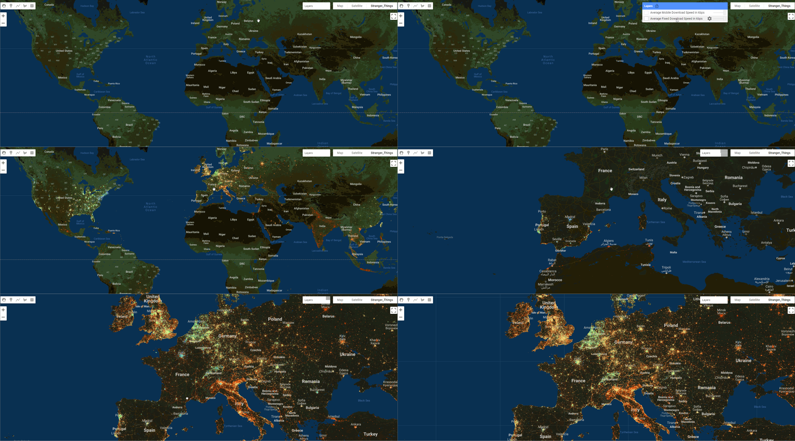
全球固定宽带和移动(蜂窝)网络数据集
全球固定宽带和移动(蜂窝)网络性能
全球固定宽带和移动(蜂窝)网络性能,分配给缩放级别为16的web mercator瓦片(赤道上约610.8米乘610.8米)。数据以Shapefile格式和Apache Parquet格式提供,几何图形以WKT格式表示,以EPSG:4326投影。下载速度、上传速度和延迟是通过Android和iOS的Speedtest by Ookla应用程序收集的,并对每块地进行平均。测量结果被过滤为含有GPS质量的位置精度的结果。
可用的数据集年份:2019,2020,2021和2022年
Citation
Find the GitHub project and datasets here: You can also download the datasets from AWS Open data registry:
瓷砖
在Ookla平台上,每月都有数以亿计的Speedtests。为了创建一个可管理的数据集,我们将原始数据汇总成瓦片。数据瓦片的大小被定义为 "缩放级别"(或 "Z")的函数。在Z=0的时候,一个瓦片的大小是整个世界的大小。在Z=1的时候,瓦片在垂直和水平方向上被分成两半,形成4个覆盖全球的瓦片。这种瓦片分割随着缩放级别的增加而继续进行,当我们放大到一个特定的区域时,瓦片会以指数形式变小。根据这个定义,瓦片的大小实际上是根据Web墨卡托投影(EPSG:3857)的地球宽度/高度的一些分数。因此,瓦片大小因纬度不同而略有不同,但瓦片大小可以用米来估计。
为了这些图层的目的,缩放级别为16(z=16)的瓦片被用于绘制。这相当于在赤道上的瓦片大约是610.8米乘610.8米(18角秒块)。每一瓦片的几何形状在瓦片字段中以WGS 84(EPSG:4326)表示。
瓦片属性
每个瓦片都包含以下相邻的属性:
| Field Name | Type | Description |
|---|---|---|
| avg_d_kbps | Integer | The average download speed of all tests performed in the tile, represented in kilobits per second. |
| avg_u_kbps | Integer | The average upload speed of all tests performed in the tile, represented in kilobits per second. |
| avg_lat_ms | Integer | The average latency of all tests performed in the tile, represented in milliseconds |
| tests | Integer | The number of tests taken in the tile. |
| devices | Integer | The number of unique devices contributing tests in the tile. |
| quadkey | Text | The quadkey representing the tile. |
Quadkeys
四键可以作为瓦片的唯一标识符。这对于在空间上连接多个时期(季度)的数据、在不使用地理空间函数的情况下创建更粗略的空间聚合、空间索引、分区以及存储和推导瓦片几何形状的替代方法都很有用。
图层
两个图层作为独立的文件集分发:
performance_mobile_tiles - 瓷砖包含从具有GPS质量的位置和蜂窝连接类型(如4G LTE、5G NR)的移动设备上进行的测试。
performance_fixed_tiles - 瓷砖包含从移动设备上进行的测试,具有GPS质量的位置和非蜂窝连接类型(如WiFi,以太网)。
时间周期和更新频率
图层是根据一个季度的数据(三个月)生成的,文件将按季度更新和添加。一个/year=2020/quarter=1/期间,即2020年的第一个季度,将包括所有在2020-01-01或之后、2020-04-01之前产生的数据。
为了满足数据主体访问请求(DSAR),数据将被定期重新分类,这在某些司法管辖区的法律中是适用的,包括但不限于《通用数据保护条例》(GDPR)、《加州消费者隐私法案》(CCPA)和《Lei Geral de Proteção de Dados》(LGPD)。因此,在不同时间访问的数据可能会导致测试总数、瓦片和由此产生的性能指标的变化。

Earth Engine Snippet
Sample Code:
Earth Engine files for mobile and fixed tiles across different quarters are arranged in the format, since quarters are 3 month intervals replace month variable by 01,04,07,10 which represents 3 month intervals
Raster Datasets
As part of processing this datasets I further converted these datasets into 32 bit float rasters , these are produced at 610m resolution and feature property such as avg_d_kbps,avg_u_kbps,avg_lat_ms,devices,tests are converted in Bands for these images. The start and end date for each quarter are further added to the images however the quad information is not retained from vector to raster conversion. The result are two image collections for fixed and mobile datasets.
Earth Engine Snippet
Sample Code:
License
These datasets are made available under a Attribution-NonCommercial-ShareAlike 4.0 International (CC BY-NC-SA 4.0)
Provided by: Ookla
Curated in GEE by: Samapriya Roy
Keywords: : analytics,broadband,cities,civic,infrastructure,internet,network traffic, telecommunications,tiles
Last updated: 2023-03-25
- 点赞
- 收藏
- 关注作者


评论(0)