Google Earth Engine ——基于ENVISAT的中分辨率成像光谱仪全球土地覆盖300米分辨率数据集
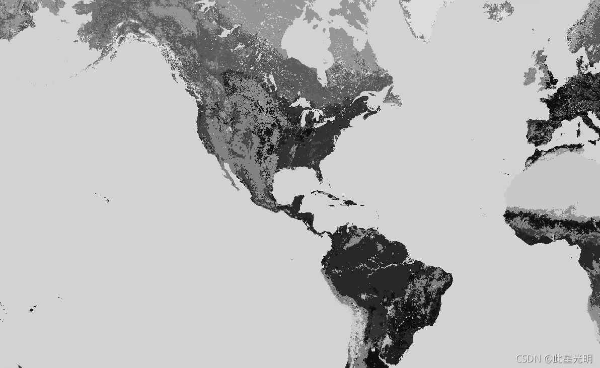
GlobCover 2009 is a global land cover map based on ENVISAT's Medium Resolution Imaging Spectrometer (MERIS) Level 1B data acquired in full resolution mode with a spatial resolution of approximately 300 meters.
GlobCover 2009是基于ENVISAT的中分辨率成像光谱仪(MERIS)1B级数据的全球土地覆盖图,以全分辨率模式获取,空间分辨率约为300米。
Dataset Availability
2009-01-01T00:00:00 - 2010-01-01T00:00:00
Dataset Provider
Collection Snippet
ee.Image("ESA/GLOBCOVER_L4_200901_200912_V2_3")
Resolution
300 meters
Bands Table
| Name | Description |
|---|---|
| landcover | The land cover map is derived by an automatic and regionally-tuned classification of a time series of global MERIS FR mosaics for the year 2009. The global land cover map counts 22 land cover classes defined with the United Nations (UN) Land Cover Classification System (LCCS). |
| qa | Binary quality band indicating whether the reference dataset has been used instead of the output of the GlobCover classification scheme. |
| qa Bitmask |
|
Class Table: landcover
| Value | Color | Color Value | Description |
|---|---|---|---|
| 11 | #aaefef | Post-flooding or irrigated croplands | |
| 14 | #ffff63 | Rainfed croplands | |
| 20 | #dcef63 | Mosaic cropland (50-70%) / vegetation (grassland, shrubland, forest) (20-50%) | |
| 30 | #cdcd64 | Mosaic vegetation (grassland, shrubland, forest) (50-70%) / cropland (20-50%) | |
| 40 | #006300 | Closed to open (>15%) broadleaved evergreen and/or semi-deciduous forest (>5m) | |
| 50 | #009f00 | Closed (>40%) broadleaved deciduous forest (>5m) | |
| 60 | #aac700 | Open (15-40%) broadleaved deciduous forest (>5m) | |
| 70 | #003b00 | Closed (>40%) needleleaved evergreen forest (>5m) | |
| 90 | #286300 | Open (15-40%) needleleaved deciduous or evergreen forest (>5m) | |
| 100 | #788300 | Closed to open (>15%) mixed broadleaved and needleleaved forest (>5m) | |
| 110 | #8d9f00 | Mosaic forest-shrubland (50-70%) / grassland (20-50%) | |
| 120 | #bd9500 | Mosaic grassland (50-70%) / forest-shrubland (20-50%) | |
| 130 | #956300 | Closed to open (>15%) shrubland (<5m) | |
| 140 | #ffb431 | Closed to open (>15%) grassland | |
| 150 | #ffebae | Sparse (>15%) vegetation (woody vegetation, shrubs, grassland) | |
| 160 | #00785a | Closed (>40%) broadleaved forest regularly flooded - Fresh water | |
| 170 | #009578 | Closed (>40%) broadleaved semi-deciduous and/or evergreen forest regularly flooded - saline water | |
| 180 | #00dc83 | Closed to open (>15%) vegetation (grassland, shrubland, woody vegetation) on regularly flooded or waterlogged soil - fresh, brackish or saline water | |
| 190 | #c31300 | Artificial surfaces and associated areas (urban areas >50%) GLOBCOVER 2009 | |
| 200 | #fff5d6 | Bare areas | |
| 210 | #0046c7 | Water bodies | |
| 220 | #ffffff | Permanent snow and ice | |
| 230 | #743411 | Unclassified |
var dataset = ee.Image('ESA/GLOBCOVER_L4_200901_200912_V2_3');
var landcover = dataset.select('landcover');
Map.setCenter(-88.6, 26.4, 3);
Map.addLayer(landcover, {}, 'Landcover');
数据声明:
GlobCover产品由欧空局和卢湾天主教大学处理。它们由欧空局向公众提供。您可以出于教育和/或科学目的使用GlobCover土地覆盖图,而无需支付任何费用,条件是您必须将ESA和卢万天主教大学作为GlobCover产品的来源。
数据引用:
ESA 2010 and UCLouvain. ESA Data User Element

文章来源: blog.csdn.net,作者:此星光明2021年博客之星云计算Top3,版权归原作者所有,如需转载,请联系作者。
原文链接:blog.csdn.net/qq_31988139/article/details/120215738
- 点赞
- 收藏
- 关注作者


评论(0)