Google Earth Engine——飓风最佳轨迹数据库(HURDAT2)。太平洋盆地1949-2018年。

【摘要】
Hurricane best track database (HURDAT2).
Pacific basin 1949-2018.
飓风最佳轨迹数据库(HURDAT2)。
太平洋盆地1949-2018年。
Dataset Availability
1949-06-11T00:00:00 - 2018-11-09T00:00:0...
Hurricane best track database (HURDAT2).
Pacific basin 1949-2018.
飓风最佳轨迹数据库(HURDAT2)。
太平洋盆地1949-2018年。
Dataset Availability
1949-06-11T00:00:00 - 2018-11-09T00:00:00
Dataset Provider
Collection Snippet
ee.FeatureCollection("NOAA/NHC/HURDAT2/pacific")
| Name | Type | Description |
|---|---|---|
| seq | Double | ATCF cyclone number for that year |
| name | String | Hurricane name. e.g. "ALEX" |
| datetime | String | Observation time in UTC. Format is YYYY-MM-DDTHH:MM:SS. |
| record_id | String | Single letter desinating a specific event in a hurricane track. An empty string if no code. - C – Closest approach to a coast not followed by a landfall - G – Genesis - I – An intensity peak in terms of both pressure and wind - L – Landfall (center of system crossing a coastline) - P – Minimum in central pressure - R – Provides additional detail on the intensity of the cyclone when rapid changes are underway - S – Change of status of the system - T – Provides additional detail on the track (position) of the cyclone - W – Maximum sustained wind speed |
| status | String | Status of system: - DB – Disturbance (of any intensity) - ET - Unknown. The only occurrence is in HARVEY. - EX – Extratropical cyclone (of any intensity) - HU – Tropical cyclone of hurricane intensity (> 64 knots) - LO – A low that is neither a tropical cyclone, a subtropical cyclone, nor an extratropical cyclone (of any intensity) - SD – Subtropical cyclone of subtropical depression intensity (< 34 knots) - SS – Subtropical cyclone of subtropical storm intensity (> 34 knots) - TD – Tropical cyclone of tropical depression intensity (< 34 knots) - TS – Tropical cyclone of tropical storm intensity (34-63 knots) - WV – Tropical Wave (of any intensity) |
| max_wind_kts | Double | Maximum wind speed |
| min_pressure | Double | Minimum pressure |
| numEntries | Double | Number of points for a particular hurricane |
| radii_ne_34kt | Double | 34 kt wind radii maximum extent in northeastern quadrant |
| radii_se_34kt | Double | 34 kt wind radii maximum extent in southeastern quadrant |
| radii_sw_34kt | Double | 34 kt wind radii maximum extent in southwestern quadrant |
| radii_nw_34kt | Double | 34 kt wind radii maximum extent in northwestern quadrant |
| radii_ne_50kt | Double | 50 kt wind radii maximum extent in northeastern quadrant |
| radii_se_50kt | Double | 50 kt wind radii maximum extent in southeastern quadrant |
| radii_sw_50kt | Double | 50 kt wind radii maximum extent in southwestern quadrant |
| radii_nw_50kt | Double | 50 kt wind radii maximum extent in northwestern quadrant |
| radii_ne_64kt | Double | 64 kt wind radii maximum extent in northeastern quadrant |
| radii_se_64kt | Double | 64 kt wind radii maximum extent in southeastern quadrant |
| radii_sw_64kt | Double | 64 kt wind radii maximum extent in southwestern quadrant |
| radii_nw_64kt | Double | 64 kt wind radii maximum extent in northwestern quadrant |
| basin | String | Ocean basin. Always "AL" for Atlantic. |
| id | String | Code for a particular hurricane. "AL" followed by a 2 digit cyclone number followed by a 4-digit year. e.g. "AL162018" |
| year | Double | Year in which the hurricane occurred |
使用说明:
NOAA data, information, and products, regardless of the method of delivery, are not subject to copyright and carry no restrictions on their subsequent use by the public. Once obtained, they may be put to any lawful use.NOAA的数据、信息和产品,无论其交付方式如何,都不受版权保护,对公众的后续使用也没有限制。一旦获得,它们可以被用于任何合法用途。
代码:
-
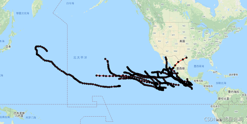
// Show hurricane tracks and points for 1993.
-
var hurricanes = ee.FeatureCollection('NOAA/NHC/HURDAT2/pacific');
-
-
var year = '1993';
-
var points = hurricanes.filter(ee.Filter.date(ee.Date(year).getRange('year')));
-
-
// Find all of the hurricane ids.
-
var GetId = function(point) {
-
return ee.Feature(point).get('id');
-
};
-
var storm_ids = points.toList(1000).map(GetId).distinct();
-
-
// Create a line for each hurricane.
-
var lines = ee.FeatureCollection(storm_ids.map(function(storm_id){
-
var pts = points.filter(ee.Filter.eq('id', ee.String(storm_id)));
-
pts = pts.sort('system:time_start');
-
var line = ee.Geometry.LineString(pts.geometry().coordinates());
-
var feature = ee.Feature(line);
-
return feature.set('id', storm_id);
-
}));
-
-
Map.addLayer(lines, {color: 'red'}, 'tracks');
-
Map.addLayer(points, {color: 'black'}, 'points');
-
-
Map.setCenter(210, 30, 3);
文章来源: blog.csdn.net,作者:此星光明2021年博客之星云计算Top3,版权归原作者所有,如需转载,请联系作者。
原文链接:blog.csdn.net/qq_31988139/article/details/120589565

【版权声明】本文为华为云社区用户转载文章,如果您发现本社区中有涉嫌抄袭的内容,欢迎发送邮件进行举报,并提供相关证据,一经查实,本社区将立刻删除涉嫌侵权内容,举报邮箱:
cloudbbs@huaweicloud.com
- 点赞
- 收藏
- 关注作者
评论(0)